From the parking area, follow a short path downhill and turn right onto a woods road that descends parallel to Russell Brook, on the left. At the base of the descent, the road turns left and crosses the brook on a wooden bridge (to the right, a short distance upstream, are the stone abutments of the original bridge over the brook). Just ahead, you’ll pass a trail register on the left and reach...
Hike Description:
From the parking area, follow a short path downhill and turn right onto a woods road that descends parallel to Russell Brook, on the left. At the base of the descent, the road turns left and crosses the brook on a wooden bridge (to the right, a short distance upstream, are the stone abutments of the original bridge over the brook). Just ahead, you’ll pass a trail register on the left and reach a Y-intersection. Bear left at this fork, following the signs to Mud Pond, an d continue along a blue-blazed snowmobile trail. After crossing another bridge over a tributary stream, the trail begins to climb, first rather steeply, then more gradually.
In about a mile, after a short descent, you’ll reach a trail junction, marked by signs. Continue ahead for 500 feet on the wide woods road, now following the blue-blazed Mud Pond Trail, then turn left onto an unmarked path that leads down to Mud Pond. Despite its name, Mud Pond is a very attractive body of water, and both fishing and swimming (at your own risk) are permitted. You’ll want to spend a few minutes at the shore of this pond.
Now return to the Mud Pond Trail and turn left. Just ahead, you’ll notice some bluestone foundations to the left of the trail – remnants of old settlements in the area. You may wish to explore these interesting ruins, but use caution, as there are some steep drop-offs.
After checking out these interesting historical relics, retrace your steps to th e trail junction, marked by the signs, and turn left (east) onto a grassy path -- the continuation of the route of the blue-blazed Mud Pond Trail. After a short climb, the trail crosses the remnants of an old stone wall and levels off, passing through abandoned fields that are now overgrown with young maple trees. The trail descends slightly, crosses a branch of Russell Brook, then starts a gradual climb to a spur of Cherry Ridge. Unfortunately, there are no views from the crest of the rise.
The trail now begins a steady descent, rather steeply in places, reaching Trout Pond at the base of the descent. The largest wilderness lake in this area of the Catskills, Trout Pond offers opportunities for fishing and swimming (again, at your own risk). The trail bears left and crosses the pond’s inlet stream on a wooden bridge. Just beyond, a short side trail on the left leads to a lean-to. This is a good place to stop for lunch.
 When you’re ready to continue, return to the main trail and bear left. Almost immediately, you’ll reach a junction with the Trout Pond Trail. The Mud Pond Trail ends here, but you should continue heading south along the eastern side of the pond, following the Trout Pond Trail (also blazed blue). In about half a mile, you’ll reach the southern end of the pond, where there are views over the pond from the dam just to the right of the trail. The trail now descends on a woods road through a mixed deciduous and evergreen forest, with the pond’s outlet stream on the right.
In about 20 minutes, you’ll reach an open area where the snowmobile trail you followed at the start of the hike comes in from the right. Continue ahead on the Trout Pond Trail, which crosses Russell Brook on a wooden bridge, curves to the right, and climbs to the parking area on Russell Brook Road, where the hike began
Publication: Submitted by Daniel Chazin on 09/18/2003 updated/verified on 09/09/2015

This loop hike in the western Catskills climbs through a ravine to reach Mud Pond, with interesting stone foundations from former settlements, and continues to scenic Trout Pond, with opportunities for fishing and swimming.
41.994457, -74.940834
Delaware Co., NY
5 mi
3 hrs

Buy Map: Catskill Trails Map
Avenza App Map: Catskill 144
Hike Checklist:
Whether you are going for a day hike or backpacking overnight, it is good practice to carry what we call The Hiking Essentials. These essentials will help you enjoy your outing more and will provide basic safety gear if needed. There may also be more essentials, depending on the season and your needs.
The Essentials
Hiking Shoes or Boots
Water - Two quarts per person is recommended in every season. Keep in mind that fluid loss is heightened in winter as well as summer. Don't put yourself in the position of having to end your hike early because you have run out of water.
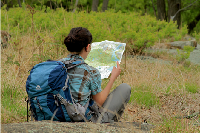
Map - Know where you are and where you are going. Many of our hiking areas feature interconnecting network of trails. Use a waterproof/tear-resistant Tyvek Trail Conference map if available or enclose your map in a Ziplock plastic bag. If you have a mobile device, download Avenza’s free PDF Maps app and grab some GPS-enhanced Trail Conference maps (a backup Tyvek or paper version of the map is good to have just in case your batteries die or you don't have service). Check out some map-reading basics here.
Food - Snacks/lunch will keep you going as you burn energy walking or climbing. Nuts, seeds, and chocolate are favorites on the trail.
Sunscreen and insect repellent
Rain Gear and Extra Clothing - Rain happens. So does cold. Be prepared for changing weather. Avoid cotton--it traps water against your skin and is slow to dry. If you are wearing wet cotton and must return to your starting point, you risk getting chills that may lead to a dangerous hypothermia. Choose synthetic shirts, sweaters and/or vests and dress in layers for easy on and off.
Compass - A simple compass is all you need to orient you and your map to magnetic north.
Light - A flashlight or small, lightweight headlamp will be welcome gear if you find yourself still on the trail when darkness falls. Check the batteries before you start out and have extras in your pack.
First Aid Kit - Keep it simple, compact, and weatherproof. Know how to use the basic components.
Firestarter and Matches - In an emergency, you may need to keep yourself or someone else warm until help arrives. A firestarter (this could be as simple as leftover birthday candles that are kept inside a waterproof container) and matches (again, make sure to keep them in a waterproof container) could save a life.
Knife or Multi-tool - You may need to cut a piece of moleskin to put over a blister, repair a piece of broken equipment, or solve some other unexpected problem.
Emergency Numbers - Know the emergency numbers for the area you're going to and realize that in many locations--especially mountainous ones, your phone will not get reception.
Common Sense - Pay attention to your environment, your energy, and the condition of your companions. Has the weather turned rainy? Is daylight fading? Did you drink all your water? Did your companion fail to bring rain gear? Are you getting tired? Keep in mind that until you turn around you are (typically) only half-way to completing your hike--you must still get back to where you started from! (Exceptions are loop hikes.)
Check the weather forecast before you head out. Know the rules and regulations of the area.
The Leave No Trace Seven Principles
Plan Ahead and Prepare
- Know the regulations and special concerns for the area you'll visit.
- Prepare for extreme weather, hazards, and emergencies.
- Schedule your trip to avoid times of high use.
- Visit in small groups when possible. Consider splitting larger groups into smaller groups.
- Repackage food to minimize waste.
- Use a map and compass to eliminate the use of marking paint, rock cairns or flagging.
Travel and Camp on Durable Surfaces
- Durable surfaces include established trails and campsites, rock, gravel, dry grasses or snow.
- Protect riparian areas by camping at least 200 feet from lakes and streams.
- Good campsites are found, not made. Altering a site is not necessary.
- In popular areas:
- Concentrate use on existing trails and campsites.
- Walk single file in the middle of the trail, even when wet or muddy.
- Keep campsites small. Focus activity in areas where vegetation is absent.
- In pristine areas:
- Disperse use to prevent the creation of campsites and trails.
- Avoid places where impacts are just beginning.
- Pack it in, pack it out. Inspect your campsite and rest areas for trash or spilled foods. Pack out all trash, leftover food and litter.
- Deposit solid human waste in catholes dug 6 to 8 inches deep, at least 200 feet from water, camp and trails. Cover and disguise the cathole when finished.
- Pack out toilet paper and hygiene products.
- To wash yourself or your dishes, carry water 200 feet away from streams or lakes and use small amounts of biodegradable soap. Scatter strained dishwater.
- Preserve the past: examine, but do not touch cultural or historic structures and artifacts.
- Leave rocks, plants and other natural objects as you find them.
- Avoid introducing or transporting non-native species.
- Do not build structures, furniture, or dig trenches.
- Campfires can cause lasting impacts to the backcountry. Use a lightweight stove for cooking and enjoy a candle lantern for light.
- Where fires are permitted, use established fire rings, fire pans, or mound fires.
- Keep fires small. Only use sticks from the ground that can be broken by hand.
- Burn all wood and coals to ash, put out campfires completely, then scatter cool ashes.
- Observe wildlife from a distance. Do not follow or approach them.
- Never feed animals. Feeding wildlife damages their health, alters natural behaviors, and exposes them to predators and other dangers.
- Protect wildlife and your food by storing rations and trash securely.
- Control pets at all times, or leave them at home.
- Avoid wildlife during sensitive times: mating, nesting, raising young, or winter.
Be Considerate of Other Visitors
- Respect other visitors and protect the quality of their experience.
- Be courteous. Yield to other users on the trail.
- Step to the downhill side of the trail when encountering pack stock.
- Take breaks and camp away from trails and other visitors.
- Let nature's sounds prevail. Avoid loud voices and noises.
The Trail Conference is a 2015 Leave No Trace partner.
(c) Leave No Trace Center for Outdoor Ethics: www.LNT.org.
Directions to Trailhead :
Take NJ 17 north to the New York Thruway and continue to Exit 16. Proceed west on NY 17 to Exit 94 (Roscoe). Turn left at the end of the ramp onto County Route 179, which becomes N.Y. Route 206 in half a mile. In 2.6 miles (from Exit 94), you’ll cross the Beaver Kill. Just beyond the bridge over the stream, turn left onto Morton Hill Road, then bear right at the next intersection. In another 2.7 miles, the pavement ends. Continue ahead on the gravel road for 0.3 mile and turn left onto Russell Brook Road (marked by a sign "Seasonal Limited Use"). Follow Russell Brook Road downhill for 0.5 mile to a parking area on the right.
TRAIN TRANSPORT :
Not availableBUS TRANSPORT :
Not availableShare Your Experience
SUPPORT
 Support the trails with a donation!
Trail Conference volunteers maintain trails in this hike.
Trip Reports
rate experience September 16, 2015
Described loop hike also has good workout
<p>If you look at the contours on the Trail Conference map, you'll see that the loop hike I describe has an elevation gain of about 750 feet from Russell Brook to the top of the ridge. So you get a nice workout with this hike, too. Moreover, this is a loop hike which also visits the intersting Mud Pond.</p>
September 15, 2015
Hike South For More Exercise
<p>My wife and daughter visited Trout Pond yesterday. It being a damp, post-Labor Day Monday, the trail was deserted, and the leaves were just starting to turn.</p>
<p> </p>
<p>Instead of taking the route described here, we parked at the (empty) lot on Campbell Brook Road and took the trail south. We had to cut the hike short when one of our party became sick, but the out-and-back to Trout Pond had, as best as I can read on the NYNJTC map, a roughly 900' - 1000' total climb over 3.4 miles.</p>
<p> </p>
<p>If you're looking to give your legs a bit more of a workout, that's the route to take.</p>
May 22, 2014
Trout Pond
<p>Yes, the campsites are available on a first-come, first-served basis. My experience is that Trout Pond is very popular on weekends but less so on weekdays. As to getting there, there is a parking area on Russell Brook Road (it must be approached from the north, as most of the road along the brook was washed out a number of years ago), and you hike in from there on a trail that follows a woods road. The woods road leads around the northern side of the pond to the lean-tos, which are at the western end. There are several designated campsites near the western end of the pond, and there is also a designated campsite at the southeastern corner of the pond, across the pond's outlet. There is no formal trail along the southern side of the pond.</p>