From the parking area, turn right on the Main Trail, a wide gravel path, and head east. You'll pass a kiosk with a donation box. To help support the costs of maintaining the property, non-members are requested to pay a small fee to hike through the nature center property ($2 per person or $10 per family, payable either in cash or by scanning a QR code). Continue along the Main Trail for 200...
Hike Description:
From the parking area, turn right on the Main Trail, a wide gravel path, and head east. You'll pass a kiosk with a donation box. To help support the costs of maintaining the property, non-members are requested to pay a small fee to hike through the nature center property ($2 per person or $10 per family, payable either in cash or by scanning a QR code). Continue along the Main Trail for 200 feet beyond the kiosk, then turn right onto the Red Trail (blazed with red triangles). Follow the Red Trail as it heads south and then loops around to the north.
After crossing a wet area on puncheons, you’ll reach a trail junction at several huge fallen trees. Here, the Purple Trail begins. Turn right onto the Purple Trail, which immediately crosses a brook on a footbridge. In half a mile, you’ll reach an intersection where the Blue Trail begins on the right. Bear left to continue on the Purple Trail. After crossing a brook on a footbridge, the Purple Trail ends at a T-intersection with the yellow-blazed Allison Trail. Turn right onto the Allison Trail.
Where the trail bends left, there is an interesting rock formation (named "Little Rock Den" on the trail map) to the left of the trail. In another 500 feet, you'll reach a junction with the orange-blazed Haring Rock Trail. Turn right and continue south on the Haring Rock Trail, which follows a winding footpath and eventually widens to a woods road.
As you approach East Clinton Avenue, the southern boundary of the nature center, you'll notice a large boulder on the left. This is the Haring Rock, after which the trail is named. Turn left here and follow the yellow/orange-blazed Seely Trail, which proceeds southeast, parallel to East Clinton Avenue. After crossing the Green Brook on a footbridge, the Seely Trail ends at a junction with the yellow-blazed Allison Trail.
Turn left and head north on the Allison Trail, which follows a mossy woods road. In a third of a mile, you’ll reach a junction marked by a cairn. Continue to follow the yellow-blazed Allison Trail as it turns left, joining the red-blazed Little Chism Trail. Both trails cross the brook on a footbridge, then turn right and parallel the brook.
In 500 feet, you’ll reach another junction, marked by a cairn. Turn right, leaving the yellow-blazed trail, and continue along the red-blazed trail, which soon approaches US 9W. The Little Chism Trail roughly parallels this busy road, which can often be seen on the right through the trees.
After turning away from Route 9W, the red-blazed trail again approaches it at a junction marked by a cairn and a sign for the Long Path. Here, the short red-and-yellow-blazed Sweet Gum Trail leads to Route 9W at the entrance to the Greenbrook Sanctuary. Continue ahead on the red-blazed Little Chism Trail, which crosses a brook on a footbridge. A short distance beyond, you'll notice an interesting rock outcrop on the left. This formation is made up of igneous rock, known as diabase, formed when molten lava cooled underground. The Palisades cliffs (just to the east) are formed of diabase.
The Little Chism Trail once again approaches Route 9W and then turns away from it. When the Little Chism Trail ends at unpaved Hudson Avenue, cross the road and continue on the red-and-white-blazed Bischoff Trail, which soon begins to parallel a stone wall on the left.
Before reaching the paved Montammy Road, the Bischoff Trail turns left, goes through a gap in the stone wall, and passes to the left of a small pond. The trail then approaches Montammy Road and turns left to parallel the road. It soon crosses another stone wall, with buildings of the Montammy Country Club visible on the right, and the historic Lambier House (built in the 1870s) visible through the trees on the left. After crossing a third stone wall and briefly paralleling it, the Little Chism Trail ends at a junction with the De Filippi Trail (blazed with white triangles).
Turn right onto the De Filippi Trail and descend to Pfister's Pond. The trail bears left and follows the shoreline of the pond, with portions of the trail routed onto boardwalks. Along the way, you’ll pass a wooden shelter (for day use only) facing the pond. When the De Filippi Trail ends at a junction with a wide gravel road (the Main Trail), turn right and follow the road back to the parking area where the hike began, passing a viewpoint over the pond on the way.
Publication: Submitted by Daniel Chazin on 04/08/2005 updated/verified on 01/10/2022

This loop hike circles the nature preserve, passing interesting rock formations and an attractive pond.
40.9247, -73.945069
Bergen Co., NJ
5 mi
2.5 hrs

Web Map: Tenafly Nature Center Trail Map
Buy Map: *New* Hudson Palisades Trails Map
Avenza App Map: Hudson Palisades 108
Hike Checklist:
Whether you are going for a day hike or backpacking overnight, it is good practice to carry what we call The Hiking Essentials. These essentials will help you enjoy your outing more and will provide basic safety gear if needed. There may also be more essentials, depending on the season and your needs.
The Essentials
Hiking Shoes or Boots
Water - Two quarts per person is recommended in every season. Keep in mind that fluid loss is heightened in winter as well as summer. Don't put yourself in the position of having to end your hike early because you have run out of water.
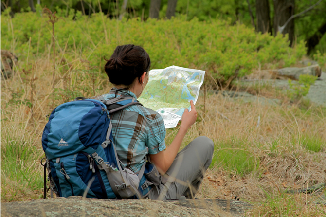
Map - Know where you are and where you are going. Many of our hiking areas feature interconnecting network of trails. Use a waterproof/tear-resistant Tyvek Trail Conference map if available or enclose your map in a Ziplock plastic bag. If you have a mobile device, download Avenza’s free PDF Maps app and grab some GPS-enhanced Trail Conference maps (a backup Tyvek or paper version of the map is good to have just in case your batteries die or you don't have service). Check out some map-reading basics here.
Food - Snacks/lunch will keep you going as you burn energy walking or climbing. Nuts, seeds, and chocolate are favorites on the trail.
Sunscreen and insect repellent
Rain Gear and Extra Clothing - Rain happens. So does cold. Be prepared for changing weather. Avoid cotton--it traps water against your skin and is slow to dry. If you are wearing wet cotton and must return to your starting point, you risk getting chills that may lead to a dangerous hypothermia. Choose synthetic shirts, sweaters and/or vests and dress in layers for easy on and off.
Compass - A simple compass is all you need to orient you and your map to magnetic north.
Light - A flashlight or small, lightweight headlamp will be welcome gear if you find yourself still on the trail when darkness falls. Check the batteries before you start out and have extras in your pack.
First Aid Kit - Keep it simple, compact, and weatherproof. Know how to use the basic components.
Firestarter and Matches - In an emergency, you may need to keep yourself or someone else warm until help arrives. A firestarter (this could be as simple as leftover birthday candles that are kept inside a waterproof container) and matches (again, make sure to keep them in a waterproof container) could save a life.
Knife or Multi-tool - You may need to cut a piece of moleskin to put over a blister, repair a piece of broken equipment, or solve some other unexpected problem.
Emergency Numbers - Know the emergency numbers for the area you're going to and realize that in many locations--especially mountainous ones, your phone will not get reception.
Common Sense - Pay attention to your environment, your energy, and the condition of your companions. Has the weather turned rainy? Is daylight fading? Did you drink all your water? Did your companion fail to bring rain gear? Are you getting tired? Keep in mind that until you turn around you are (typically) only half-way to completing your hike--you must still get back to where you started from! (Exceptions are loop hikes.)
Check the weather forecast before you head out. Know the rules and regulations of the area.
The Leave No Trace Seven Principles
Plan Ahead and Prepare
- Know the regulations and special concerns for the area you'll visit.
- Prepare for extreme weather, hazards, and emergencies.
- Schedule your trip to avoid times of high use.
- Visit in small groups when possible. Consider splitting larger groups into smaller groups.
- Repackage food to minimize waste.
- Use a map and compass to eliminate the use of marking paint, rock cairns or flagging.
Travel and Camp on Durable Surfaces
- Durable surfaces include established trails and campsites, rock, gravel, dry grasses or snow.
- Protect riparian areas by camping at least 200 feet from lakes and streams.
- Good campsites are found, not made. Altering a site is not necessary.
- In popular areas:
- Concentrate use on existing trails and campsites.
- Walk single file in the middle of the trail, even when wet or muddy.
- Keep campsites small. Focus activity in areas where vegetation is absent.
- In pristine areas:
- Disperse use to prevent the creation of campsites and trails.
- Avoid places where impacts are just beginning.
- Pack it in, pack it out. Inspect your campsite and rest areas for trash or spilled foods. Pack out all trash, leftover food and litter.
- Deposit solid human waste in catholes dug 6 to 8 inches deep, at least 200 feet from water, camp and trails. Cover and disguise the cathole when finished.
- Pack out toilet paper and hygiene products.
- To wash yourself or your dishes, carry water 200 feet away from streams or lakes and use small amounts of biodegradable soap. Scatter strained dishwater.
- Preserve the past: examine, but do not touch cultural or historic structures and artifacts.
- Leave rocks, plants and other natural objects as you find them.
- Avoid introducing or transporting non-native species.
- Do not build structures, furniture, or dig trenches.
- Campfires can cause lasting impacts to the backcountry. Use a lightweight stove for cooking and enjoy a candle lantern for light.
- Where fires are permitted, use established fire rings, fire pans, or mound fires.
- Keep fires small. Only use sticks from the ground that can be broken by hand.
- Burn all wood and coals to ash, put out campfires completely, then scatter cool ashes.
- Observe wildlife from a distance. Do not follow or approach them.
- Never feed animals. Feeding wildlife damages their health, alters natural behaviors, and exposes them to predators and other dangers.
- Protect wildlife and your food by storing rations and trash securely.
- Control pets at all times, or leave them at home.
- Avoid wildlife during sensitive times: mating, nesting, raising young, or winter.
Be Considerate of Other Visitors
- Respect other visitors and protect the quality of their experience.
- Be courteous. Yield to other users on the trail.
- Step to the downhill side of the trail when encountering pack stock.
- Take breaks and camp away from trails and other visitors.
- Let nature's sounds prevail. Avoid loud voices and noises.
The Trail Conference is a 2015 Leave No Trace partner.
(c) Leave No Trace Center for Outdoor Ethics: www.LNT.org.
Directions to Trailhead :
Take U.S. Route 9W to the traffic light at East Clinton Avenue in Tenafly. Proceed west on East Clinton Avenue for 1.7 miles and turn right at a traffic light onto Engle Street. Continue on Engle Street until it ends at a T-intersection with Hudson Avenue. Turn right and follow Hudson Avenue to its end at the nature center, where parking is available.
TRAIN TRANSPORT :
Not availableBUS TRANSPORT :
Not availableShare Your Experience
SUPPORT
 Support the trails with a donation!
Trail Conference volunteers maintain trails in this hike.
Trip Reports
rate experience November 20, 2013
Hard to follow
<p>I was on this trail on 11/16/13 and the diredtions are confusing. In the sixth paragraph it mentions a cairn, there are two to three of them in this part of the trail. In the last paragraph you have to stay to the left, if you go to the right on the boardwalk you end up at a dead end at the northernmost part of the pond.</p>
June 10, 2012
Tenafly Nature Center & Lost Brook Preserve Virtual Tour!
<p>Check out the NJUrbanForest.com's virtual tour of the Tenafly Nature Center & Lost Brook Preserve!</p>
<p>http://njurbanforest.com/2012/03/19/tenafly-nature-center-lost-brook-preserve/</p>
<p>Plenty of pictures!</p>
<p> </p>