Watchung Reservation
This loop hike encircles the Watchung Reservation, passing ruins of an old mill, an historic village, a cemetery dating to the 1700s, a scenic gorge and an attractive lake.
Watchung Reservation trail map (available at the Trailside Nature and Science Center)
Take Interstate Route 78 West to Exit 43. At the first traffic light, turn right onto McMane Avenue. When you reach the T-intersection with Glenside Avenue, turn left. Then, in 1.2 miles, turn right onto W.R. Tracy Drive (County Route 645) and enter the reservation. You will pass Surprise Lake and some picnic areas. When you reach the traffic circle, take the first right onto Summit Lane, then turn right onto New Providence Road. The parking area is to the right, where the road makes a sharp left turn.
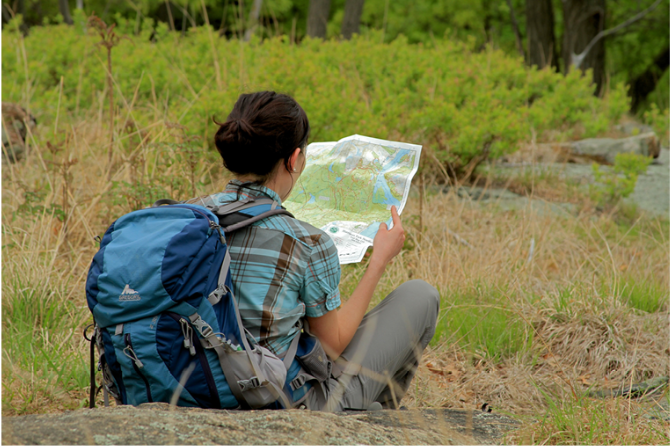
Before beginning your hike, obtain a free trail map of the reservation from the Trailside Nature and Science Center, adjacent to the parking area. Proceed west (downhill) on the extension of New Providence Road, marked with the white blazes of the Sierra Trail (which you will be following for most of the hike).
At a large sign that reads "Nature Trail," turn left, and follow the white-blazed Sierra Trail, now joined by the Green Trail, across a brook. The trails now climb to reach a T-intersection. Here, you should turn right, continuing to follow the green and white blazes, which are also joined by yellow blazes (the trail map shows this stretch as part of the Yellow Trail).
At the base of the descent, the green blazes continue ahead, crossing a wide wooden bridge, but you should turn left, now following white and orange blazes. Continue ahead at the next junction, where the Orange Trail leaves to the right and the Yellow Trail begins, but at the following junction, turn right, now following only white blazes. Soon, you'll begin to parallel a scenic gorge to the left. Along the way, the Blue Trail joins, and the path begins to descend.
At the end of the gorge, the Blue Trail leaves to the right, but you should turn left, continuing to follow the white-blazed Sierra Trail which parallels Blue Brook. The trail soon bears left and climbs away from the brook, bears left again at the next intersection, then turns right at the next junction. In another quarter of a mile, the trail crosses a small brook. Be careful to proceed straight ahead here and then bear left, uphill. After passing some houses to the left, the trail crosses a dirt road and soon begins a gradual descent.
About two miles from the start, the white blazes turn left onto a dirt road. The trail follows the dirt road for only 300 feet, and then turns left, leaving the road and continuing on a footpath. It ascends through a beautiful pine forest, planted by the CCC in the 1930s, and soon reaches an open grassy area, with a picnic pavilion ahead. Bear right here and follow a cinder road out to the paved Sky Top Drive. The trail crosses the road and re-enters the woods, then makes a sharp right turn onto a wide woods road parallel to Sky Top Drive (which often may be seen to the right). About three-quarters of a mile from the crossing of the paved road, the trail begins to descend. As the trail bends to the left, a short path to the right leads to an overlook above an abandoned quarry, with I-78 visible in the distance.
After descending more steeply, the trail makes a sharp right in sight of Route 22 and follows an eroded gully (with a number of blowdowns) down to Green Brook. It now runs along the brook, with New Providence Road on the other side. In about a third of a mile, you will reach the site of an old mill, with many brick and concrete ruins still visible. After passing the ruins of the dam that supplied power to the mill, the trail bears right and climbs steeply to an overlook, then descends and once more reaches Sky Top Drive, about four and one-half miles from the start of the hike.
The Sierra Trail turns left and follows the road, using the highway bridge to cross Blue Brook, with Seeley's Pond to the left. After crossing the bridge, the trail immediately turns right, goes through a grassy area, and re-enters the woods. It follows a footpath through some fairly dense vegetation and crosses several small brooks on a wooden boardwalk. After about three-quarters of a mile, it turns left onto a wide dirt road and finally emerges on a paved road at the Deserted Village of Feltville. Named for David Felt, a New York City businessman who founded the village in 1845 to house the workers at his nearby paper mill, it was abandoned about thirty years later. Some of the buildings in the village have been restored and are now used as private residences.
The Sierra Trail follows the paved road through the village for 0.4 mile. After the road curves left and passes the church/store building and an adjacent residence, the Sierra Trail turns right on a bridle path. In 200 feet, it turns right again onto another dirt road, and soon passes a small cemetery which contains the graves of the Willcocks and Badgley families, who first settled the area about 1736. The road soon narrows to a footpath which meanders through the woods. About a third of a mile from the cemetery, the white-blazed trail turns right, descends on a dirt road for 400 feet, then turns left, leaving the road, and immediately bears right onto a footpath.
Soon, the trail reaches the stone dam of Surprise Lake, built in 1845 to provide power for David Felt's paper mill. A short side trail leads down to the base of the dam. The Sierra Trail continues along the northwestern shore of this long but narrow lake for almost a mile, then turns right at paved Tracy Drive, crossing the lake on the shoulder of the vehicular bridge. On the other side of the bridge, the white blazes turn left, crossing the road.
Follow the white blazes for only 100 feet and turn right onto an unmarked bridle path. Just beyond, another wide path to the left leads to the park stables, but you should continue straight ahead. In about 0.2 mile, the white-blazed Sierra Trail will rejoin the bridle path. Continue ahead, following the white markers, for the next 0.4 mile, but do not turn left where they leave the path near the traffic circle; instead, bear right, continuing to follow the unmarked bridle path across the paved road.
In about 500 feet, you will meet the Sierra Trail again; this time, leave the bridle path and follow the white blazes to the right, onto a footpath. Continue ahead on the white-blazed trail, which crosses the Red Trail and then joins it. In about half a mile, the trail reaches the Trailside Nature and Science Center. Turn right onto the short path leading to the center, then turn left and follow the road to the parking area where you began the hike.
- Login or register to post comments
- Printer-friendly version
- Send by email


