Date:
05/13/2016
Shawangunk Ridge Trail (SRT) Maps provided by the Trail Conference
 These free maps of the Shawangunk Ridge Trail are provided by the New York-New Jersey Trail Conference. They are also available as a free app map on your phone using the Avenza Maps app, so be sure to download it here.
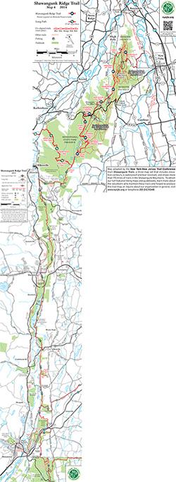
Four separate maps cover the existing trail from High Point State Park north to Mohonk Preserve; each prints on an 8.5"x11" page. These maps complement the detailed description of the Shawangunk Ridge Trail and Long Path found in The Long Path Guide.
The Shawangunk Ridge Trail is maintained by Trail Conference volunteers.
While this map may be free to use, our organization needs your support to help protect, build, and maintain more than 2,150 miles of trails throughout the region. Support the trails you love by:
- Purchasing maps and books
- Making a donation
- Volunteering your time
- Becoming a Trail Conference member
- Telling your friends and family where to find the best trail information!
Be sure to check out our selection of other free maps!
Provider:
Trail Conference
State:
NY