Join Us at the 2026 Trail Conference Annual Gala, Thursday, October 8
Trail News
Explore the Latest News, Trail Alerts, and Browse the Historic Archives
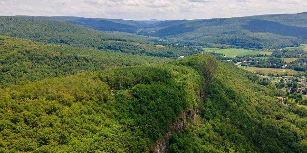
Conservation Success: Middleburgh Cliffs Now Permanently Protected
Read more: Conservation Success: Middleburgh Cliffs Now Permanently ProtectedThe Trail Conference has officially secured the permanent protection of 123.5 acres at Middleburgh Cliffs in Schoharie County, New York.

A.T. Detour at Harriman State Park
Read more: A.T. Detour at Harriman State ParkAppalachian Trail & Ramapo-Dunderberg Trail: Detour in effect at Harriman State Park The Appalachian Trail (A.T.) and Ramapo-Dunderberg Trail follow the detour shown on the map to cross the Palisades…
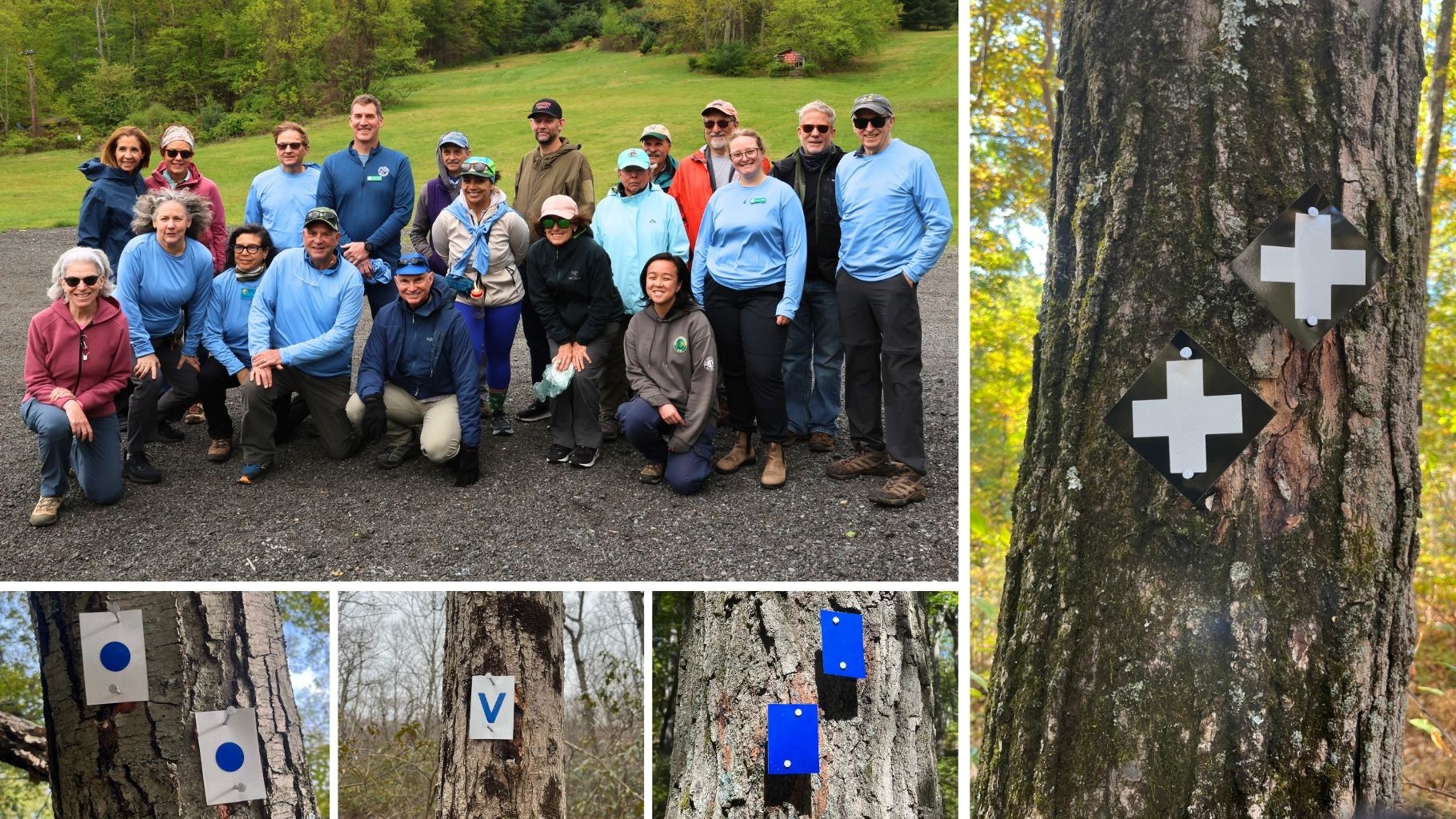
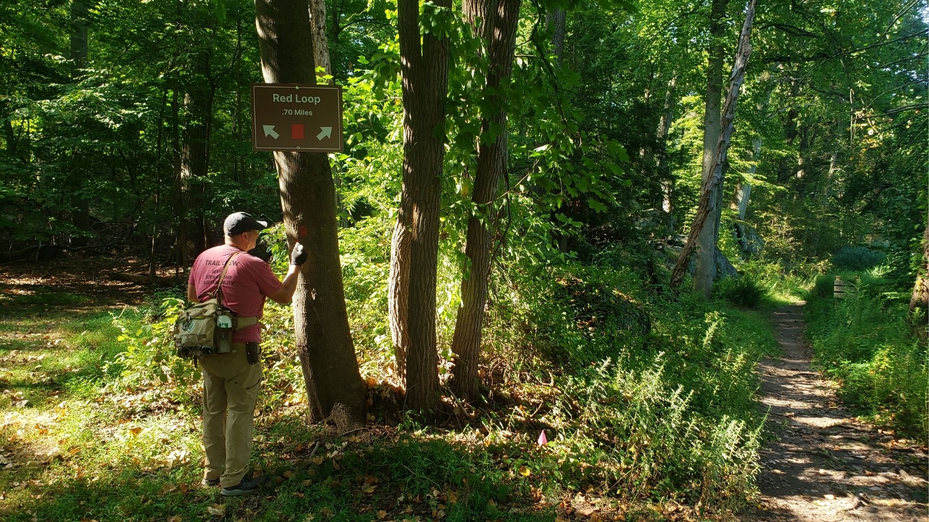
196 Miles, 26,000 Blazes: A Landmark Volunteer Achievement in Harriman and Bear Mountain State Parks
Read more: 196 Miles, 26,000 Blazes: A Landmark Volunteer Achievement in Harriman and Bear Mountain State ParksRecently, we gathered with conservation partners to celebrate an incredible trail victory: 196 miles of trails fully reblazed in Harriman and Bear Mountain State Parks!
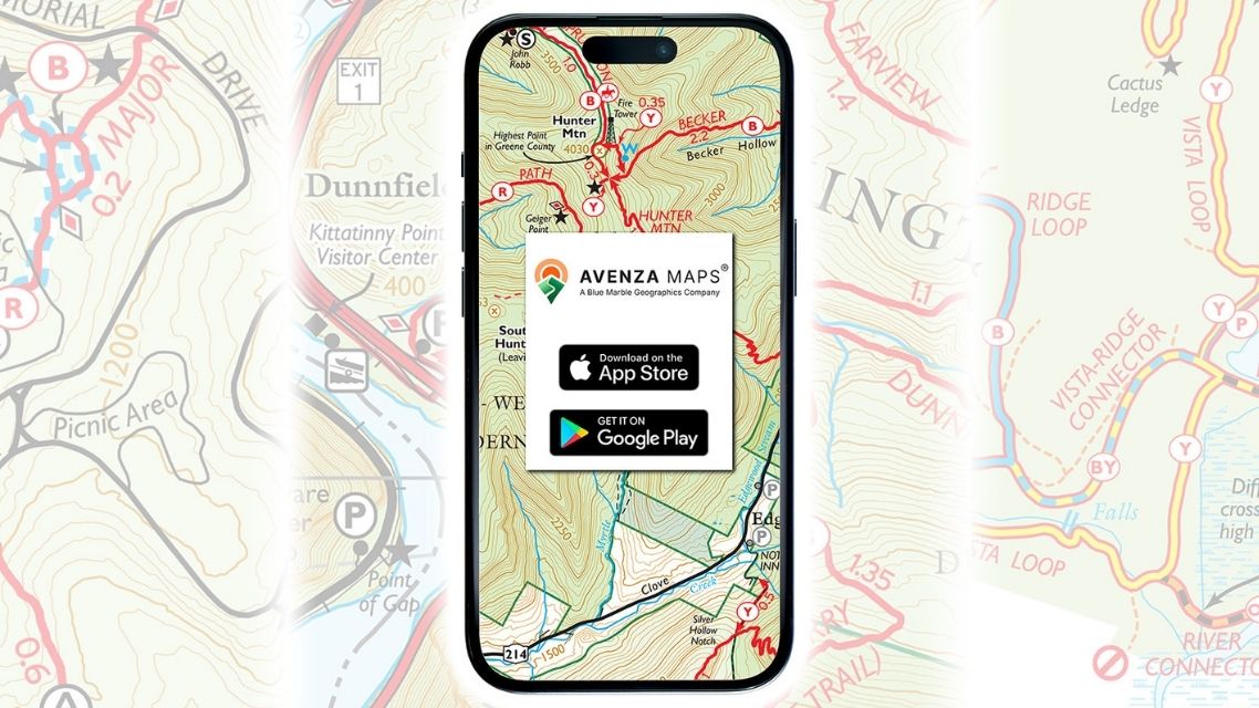
Alert: Avenza Maps Changes Will Impact the Trail Conference’s Digital Maps
Read more: Alert: Avenza Maps Changes Will Impact the Trail Conference’s Digital MapsFollowing a recent merger, Avenza Maps is undergoing significant changes that will affect trail users across the region, including those who navigate with the Trail Conference’s digital maps. Here’s what…
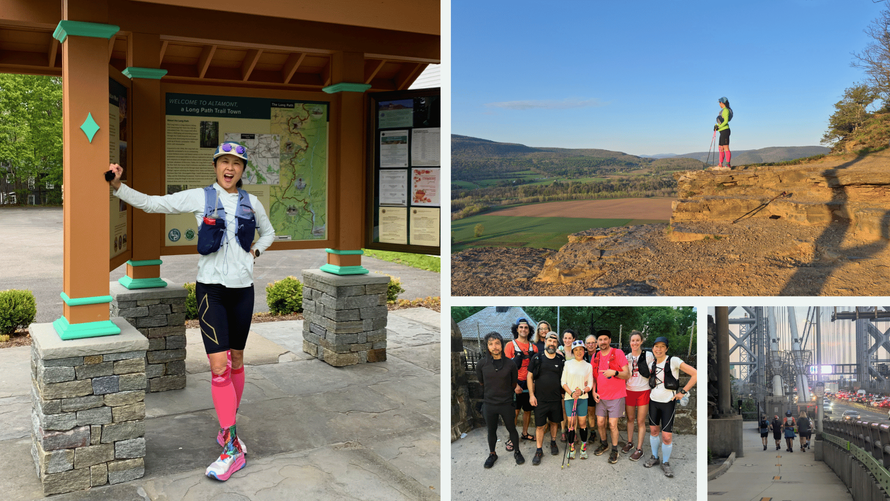
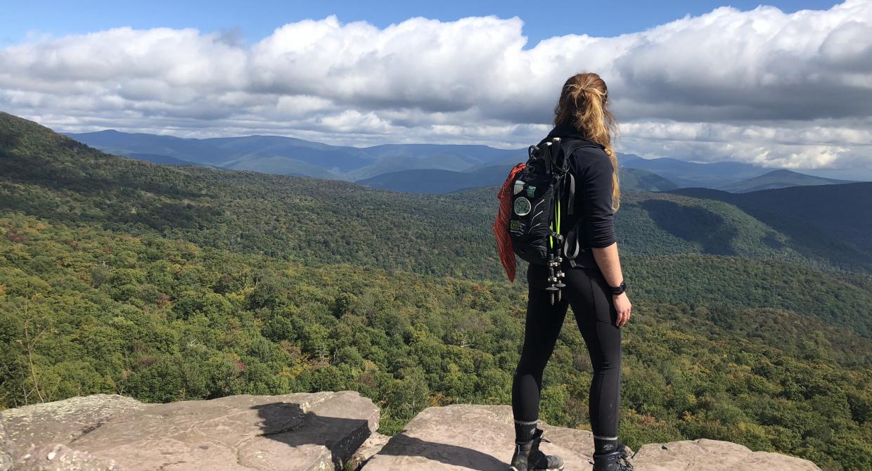
Kumi Redpath Blazes a Record-Breaking Run on the Long Path!
Read more: Kumi Redpath Blazes a Record-Breaking Run on the Long Path!On May 10, 2026, Kumi Redpath completed a record-shattering run to set a new overall supported fastest known time (FKT) on the Long Path, New York’s signature long-distance trail.
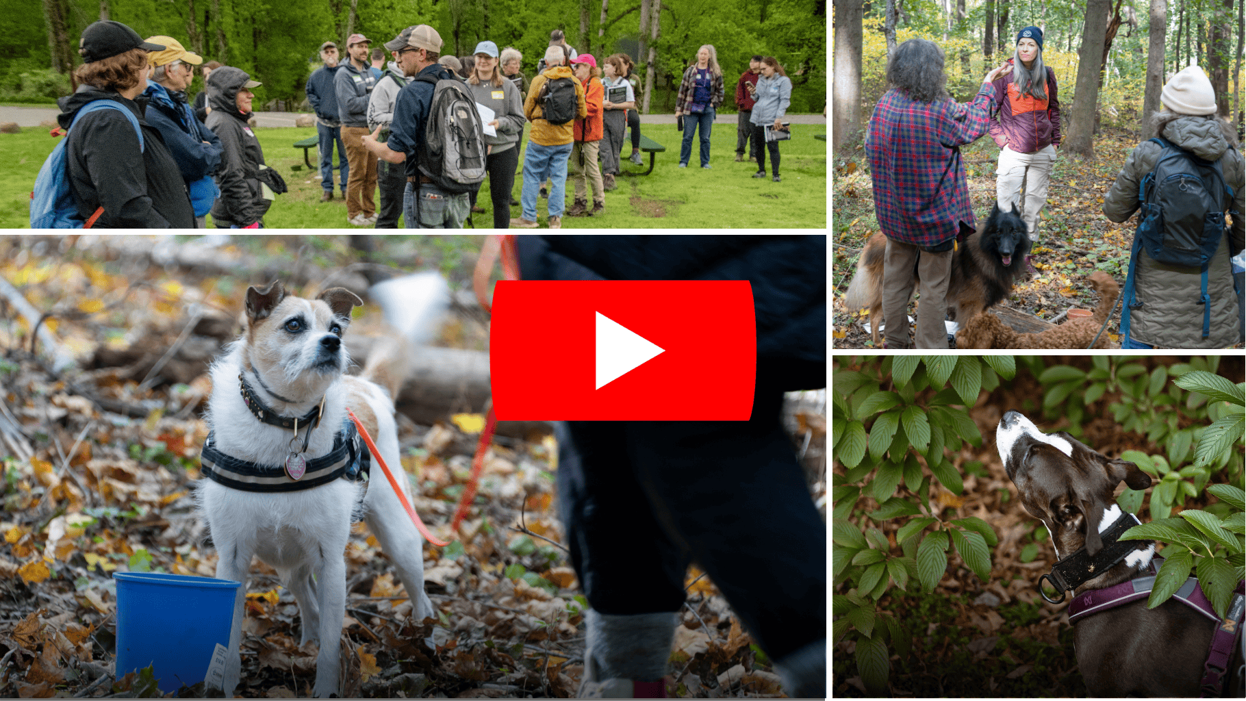
AWOOOO: Watch Our New Volunteer Dog Surveyor Program Video!
Read more: AWOOOO: Watch Our New Volunteer Dog Surveyor Program Video!We’re paws-itively delighted to share our new video for the Volunteer Dog Surveyor Program, introducing you to the people and pups who help protect our public trails.
Highlands Trail Section Closed: Rt 605 – Lackawanna Drive
Read more: Highlands Trail Section Closed: Rt 605 – Lackawanna DriveBeginning in July 2026, part of the Highlands Trail Section #5 in Byram, New Jersey will be closed to the public while EPA addresses contamination in and around the Mansfield…
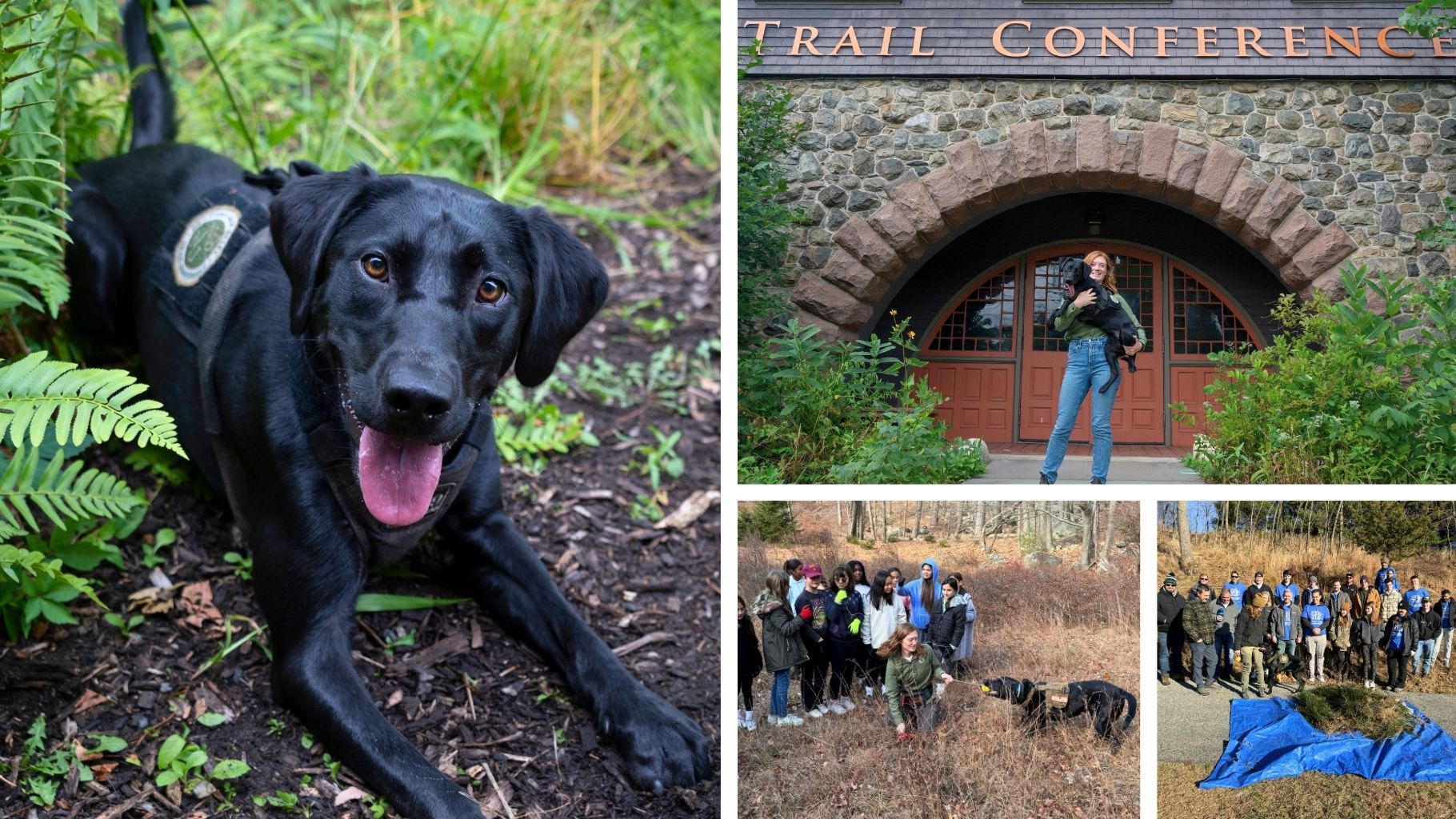
Trail Conference Awarded Generous Grant to Combat Invasive Species in the Hudson Valley
Read more: Trail Conference Awarded Generous Grant to Combat Invasive Species in the Hudson ValleyExciting news! Thanks to a generous NYS DEC grant, the Trail Conference is strengthening our Conservation Dogs Program to fight invasive species throughout the Hudson Valley.
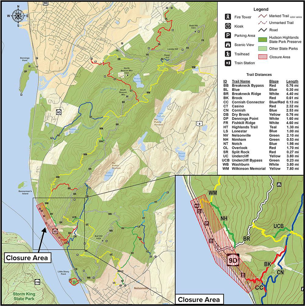
Reminder: Breakneck Ridge and Wilkinson Memorial Trailhead Closure Remains in Effect
Read more: Reminder: Breakneck Ridge and Wilkinson Memorial Trailhead Closure Remains in EffectReminder, hikers! The Breakneck and Wilkinson Memorial Trailheads and Breakneck Ridge Metro‑North station will remain closed until mid‑2027.
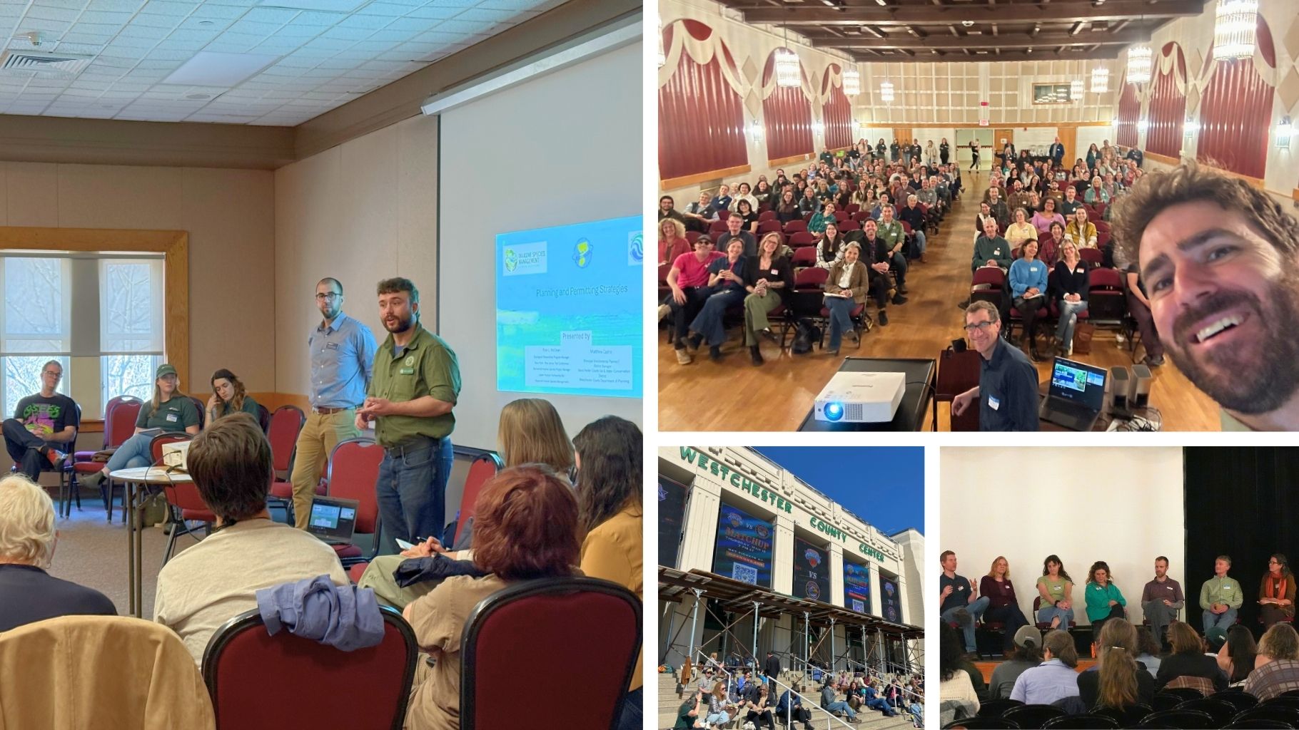
Restoring the Living Landscape Together: Highlights from a Landmark Gathering in the Hudson Valley
Read more: Restoring the Living Landscape Together: Highlights from a Landmark Gathering in the Hudson ValleyRecently, our Stewardship team joined conservation partners across the region to co-organize a transformative event—Restoring the Living Landscape Together!
NY Bear Mountain Bridge Project
Read more: NY Bear Mountain Bridge ProjectThe New York Bridge Authority announced that construction will begin this year to replace the decking on the Bear Mountain Bridge and enhance safety and accessibility on the bridge (Mile…
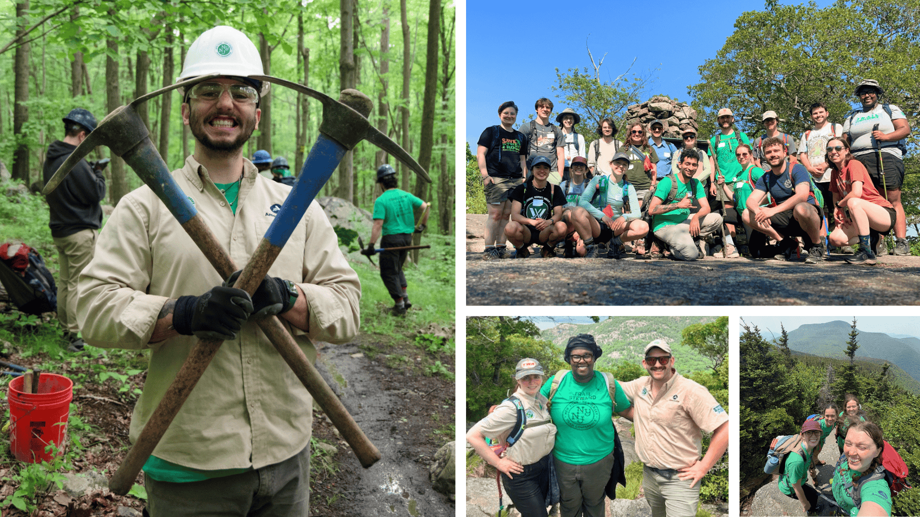
Now Accepting Applications for the 2026 Conservation Corps Season
Read more: Now Accepting Applications for the 2026 Conservation Corps SeasonWant your summer to rock? Join the Trail Conference Conservation Corps and gain hands-on experience in trail construction and outdoor leadership.
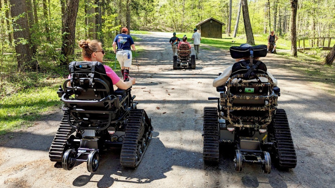
NYSDEC Seeks the Public’s Input on New Outdoor Accessibility Draft Policy
Read more: NYSDEC Seeks the Public’s Input on New Outdoor Accessibility Draft PolicyDEC has released its draft policy to improve access to the outdoors for people with mobility issues—and the public is invited to share their feedback.
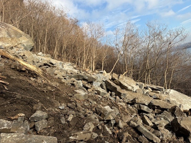
Giant Stairs Section in Palisades Interstate Park Closed Due to Major Rockfall
Read more: Giant Stairs Section in Palisades Interstate Park Closed Due to Major RockfallThe Giant Stairs section in Palisades Interstate Park is closed due to a major rockfall and slide, which occurred on the morning of 1/9/26.
Your Voice Matters: Take Our Depew Park and Blue Mountain Reservation Trail Survey
Read more: Your Voice Matters: Take Our Depew Park and Blue Mountain Reservation Trail SurveyLove exploring Depew Park and Blue Mountain Reservation in Peekskill, New York? We want your input — take our trail survey today!

Join

Become a member and protect wild places
Shop

Maps, gear & books, all proceeds support trails
Volunteer

Give back by helping maintain the trails
Donate

Keep trails open and safe with a one-time gift