Sam's Point Area of Minnewaska State Park Preserve


Park Overview:
At the southernmost promontory of the Shawangunks is Sam's Point, a massive cliff affording hikers broad views to the southeast and southwest.
Park Description:
Sam's Point Preserve
The southernmost promontory of the Shawangunks is a massive cliff called Sam's Point, which affords broad views extending from the Hudson Highlands in the southeast to High Point State Park and the Kittatinnies in the southwest. The name "Sam's Point" has also been used to designate the plateau-like mountainscape north of the promontory, formed of thick slabs of Shawangunk conglomerate. A miniature forest of evergreen heaths, blueberries, and pitch pines finds a tenuous foothold in this harsh, rocky environment. According to The Nature Conservancy, "the majestic views and unique landscapes of Sam's Point represent one of the best examples of a ridgetop dwarf pine barrens in the world."
The Preserve offers inviting destinations for hikers relatively close to the main parking area and Sam's Point Visitor Center: Sam’s Point, with its spectacular views; the Ice Caves, with its own 0.5 mile mini-loop trail, where ice and snow can be seen even in the summer ; and Lake Maratanza, the highest of the “Sky Lakes.” Further away are 180-foot Verkeerder Kill Falls, the highest waterfall in the Shawangunks; Indian Rock, a large fractured boulder perched near the top of a cliff and balanced on a smaller boulder; and High Point, the highest point in the area at 2,240 feet.
This is the highest and wildest part of the Shawangunks.
Formerly managed by The Nature Conservancy, Sam’s Point Preserve became a part of Minnewaska State Park Preserve in 2015.
Trails Overview:
Trails in the southeastern part of the preserve are open to the public for hiking, but access to the more fragile area in the northwestern part near Ellenville is by permit only, save for the Smiley Carriage Road that skirts the restricted area (see Trail Conference Map 104).
Providing access to various other hiking routes, a three-mile partially paved Loop Road (closed to private vehicles, but open to service vehicles) leads uphill from the parking area circling Lake Maratanza .
- Right Fork on Loop Road-- to Sam’s Point, the Ice Caves and Verkeerder Kills Falls: From the parking area, walk around the gate and take the right fork of the Loop Road to follow the Long Path (aqua blaze) heading southeast at this point. This branch leads to Sam’s Point, then passes by a side trail to the Ice Caves at 1.0 mile (a must to take) and reaches Verkeerder Kill Falls in 3.0 miles.
- Note: From this point, the Long Path no longer heads east towards Mud Pond. It now follows the High Point Trail (red) heading north to Berrypicker Trail (blue). Then from Smiley Carriage Road north, the LP follows the Mine Hole Trail. Click for an updated description of this section of the Long Path.
- Left Fork on Loop Road -- to Indian Rock and High Point: From the parking area, walk around the gate and take the left fork of the Loop Road heading northwest, which is briefly co-aligned with the Long Path (aqua blaze). When the Long Path leaves to the left, remain straight on the Loop Road; it will eventually reach the level of Lake Maratanza, which can be glimpsed from the road on the right. Near the most distant point of the Loop Road, as it begins to circle back around the lake, is High Point Carriage Road. Both Indian Rock and High Point are accessible from side trails along this road.
Click for detailed descriptions of hikes to the destinations mentioned above. These are moderate to strenuous hikes. Be aware that hiking the Ice Caves loop trail (white blaze) involves climbing wooden ladders.
Park Acreage:
5400.00 acresMunicipality:
CragsmoorAt the southernmost promontory of the Shawangunks is Sam's Point, a massive cliff affording hikers broad views to the southeast and southwest.
Sam's Point Preserve
The southernmost promontory of the Shawangunks is a massive cliff called Sam's Point, which affords broad views extending from the Hudson Highlands in the southeast to High Point State Park and the Kittatinnies in the southwest. The name "Sam's Point" has also been used to designate the plateau-like mountainscape north of the promontory, formed of thick slabs of...
Park Acreage:
5400.00 acresMunicipality:
CragsmoorContact Information
Web Link:
New York State Office of Parks, Recreation and Historic PreservationPhone:
(845) 647-7989Fees:
Yes, click on 'Contact Information' for further informationDogs in park:
Dogs on leash
Hike Checklist:
Whether you are going for a day hike or backpacking overnight, it is good practice to carry what we call The Hiking Essentials. These essentials will help you enjoy your outing more and will provide basic safety gear if needed. There may also be more essentials, depending on the season and your needs.
The Essentials
Hiking Shoes or Boots
Water - Two quarts per person is recommended in every season. Keep in mind that fluid loss is heightened in winter as well as summer. Don't put yourself in the position of having to end your hike early because you have run out of water.
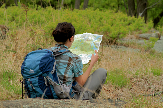
Map - Know where you are and where you are going. Many of our hiking areas feature interconnecting network of trails. Use a waterproof/tear-resistant Tyvek Trail Conference map if available or enclose your map in a Ziplock plastic bag. If you have a mobile device, download Avenza’s free PDF Maps app and grab some GPS-enhanced Trail Conference maps (a backup Tyvek or paper version of the map is good to have just in case your batteries die or you don't have service). Check out some map-reading basics here.
Food - Snacks/lunch will keep you going as you burn energy walking or climbing. Nuts, seeds, and chocolate are favorites on the trail.
Sunscreen and insect repellent
Rain Gear and Extra Clothing - Rain happens. So does cold. Be prepared for changing weather. Avoid cotton--it traps water against your skin and is slow to dry. If you are wearing wet cotton and must return to your starting point, you risk getting chills that may lead to a dangerous hypothermia. Choose synthetic shirts, sweaters and/or vests and dress in layers for easy on and off.
Compass - A simple compass is all you need to orient you and your map to magnetic north.
Light - A flashlight or small, lightweight headlamp will be welcome gear if you find yourself still on the trail when darkness falls. Check the batteries before you start out and have extras in your pack.
First Aid Kit - Keep it simple, compact, and weatherproof. Know how to use the basic components.
Firestarter and Matches - In an emergency, you may need to keep yourself or someone else warm until help arrives. A firestarter (this could be as simple as leftover birthday candles that are kept inside a waterproof container) and matches (again, make sure to keep them in a waterproof container) could save a life.
Knife or Multi-tool - You may need to cut a piece of moleskin to put over a blister, repair a piece of broken equipment, or solve some other unexpected problem.
Emergency Numbers - Know the emergency numbers for the area you're going to and realize that in many locations--especially mountainous ones, your phone will not get reception.
Common Sense - Pay attention to your environment, your energy, and the condition of your companions. Has the weather turned rainy? Is daylight fading? Did you drink all your water? Did your companion fail to bring rain gear? Are you getting tired? Keep in mind that until you turn around you are (typically) only half-way to completing your hike--you must still get back to where you started from! (Exceptions are loop hikes.)
Check the weather forecast before you head out. Know the rules and regulations of the area.
The Leave No Trace Seven Principles
Plan Ahead and Prepare
- Know the regulations and special concerns for the area you'll visit.
- Prepare for extreme weather, hazards, and emergencies.
- Schedule your trip to avoid times of high use.
- Visit in small groups when possible. Consider splitting larger groups into smaller groups.
- Repackage food to minimize waste.
- Use a map and compass to eliminate the use of marking paint, rock cairns or flagging.
Travel and Camp on Durable Surfaces
- Durable surfaces include established trails and campsites, rock, gravel, dry grasses or snow.
- Protect riparian areas by camping at least 200 feet from lakes and streams.
- Good campsites are found, not made. Altering a site is not necessary.
- In popular areas:
- Concentrate use on existing trails and campsites.
- Walk single file in the middle of the trail, even when wet or muddy.
- Keep campsites small. Focus activity in areas where vegetation is absent.
- In pristine areas:
- Disperse use to prevent the creation of campsites and trails.
- Avoid places where impacts are just beginning.
- Pack it in, pack it out. Inspect your campsite and rest areas for trash or spilled foods. Pack out all trash, leftover food and litter.
- Deposit solid human waste in catholes dug 6 to 8 inches deep, at least 200 feet from water, camp and trails. Cover and disguise the cathole when finished.
- Pack out toilet paper and hygiene products.
- To wash yourself or your dishes, carry water 200 feet away from streams or lakes and use small amounts of biodegradable soap. Scatter strained dishwater.
- Preserve the past: examine, but do not touch cultural or historic structures and artifacts.
- Leave rocks, plants and other natural objects as you find them.
- Avoid introducing or transporting non-native species.
- Do not build structures, furniture, or dig trenches.
- Campfires can cause lasting impacts to the backcountry. Use a lightweight stove for cooking and enjoy a candle lantern for light.
- Where fires are permitted, use established fire rings, fire pans, or mound fires.
- Keep fires small. Only use sticks from the ground that can be broken by hand.
- Burn all wood and coals to ash, put out campfires completely, then scatter cool ashes.
- Observe wildlife from a distance. Do not follow or approach them.
- Never feed animals. Feeding wildlife damages their health, alters natural behaviors, and exposes them to predators and other dangers.
- Protect wildlife and your food by storing rations and trash securely.
- Control pets at all times, or leave them at home.
- Avoid wildlife during sensitive times: mating, nesting, raising young, or winter.
Be Considerate of Other Visitors
- Respect other visitors and protect the quality of their experience.
- Be courteous. Yield to other users on the trail.
- Step to the downhill side of the trail when encountering pack stock.
- Take breaks and camp away from trails and other visitors.
- Let nature's sounds prevail. Avoid loud voices and noises.
The Trail Conference is a 2015 Leave No Trace partner.
(c) Leave No Trace Center for Outdoor Ethics: www.LNT.org.
Directions to Trailhead :
Note current trailhead closures from ALERT MESSAGE on this site.
From the South: Take NJ 17 north to the New York Thruway and continue to Exit 16. Proceed west on NY 17 to Exit 119, turn right at the end of the ramp, and continue north on NY 302 for 9.6 miles to Pine Bush, where NY 302 ends. Turn left onto NY 52 and continue for 7.3 miles. Just before the crest of the hill, turn right onto Cragsmoor Road. In 1.3 miles, turn right in front of the Cragsmoor post office, then take the next right onto Sam’s Point Road, and follow it for about 1.2 miles to its end at the parking area for the preserve. A parking fee is charged per car.
From the North: Take NY 52 south from Ellenville. In about five miles, at the crest of the ridge, turn left at a sign to Cragsmoor. Proceed north for 1.4 miles, turn right in front of the Cragsmoor post office, and then immediately turn right again onto Sam's Point Road which leads to the preserve's Conservation Center and parking area.
See web trail map above for view of this parking area. GPS coordinates: 41.669963,-74.361649. Google Maps: "Sam's Point Preserve, Cragsmoor, NY 12420."
TRAIN TRANSPORT :
Not availableBUS TRANSPORT :
Short Line Bus operates limited daily and weekend service to Ellenville with a stop at Canal and Market Streets, about 0.7 mile from the trailhead to Smiley Carriage Road in Berme Road Park. Walk 0.5 mile southeast along Canal Street to turn left onto Berme Road. In roughly 300 feet turn right into Berme Road Park, follow the entrance road 0.1 mile to a parking area (GPS: 41.71342,-74.38271). Since much of the Preserve is restricted in this area to permit only, there are far fewer destination points compared to the views and features around Sam’s Point proper.
Share Your Experience
 Support the trails with a donation!